CANADIAN GEOTHERMAL ENERGY ASSOCIATION

  • About
    • Careers
    • Contact
  • Take Action!
  • Geothermal
    • Geothermal Energy
    • Geothermal vs Geo-Exchange
    • Fracking vs. Hydroshearing
  • Membership
    • Join
    • Member Portal
    • Member Directory
  • Consultations
  • Maps
  • News
  • Store
    • Bundles
    • Reports
    • CanGEA Memberships
    • Events
  • Events
    • STANFORD GEOTHERMAL WORKSHOP 2023
Harvey Barrison, CC BY-SA 2.0, via Wikimedia Commons

CANADIAN NATIONAL GEOTHERMAL DATABASE
& ​PROVINCIAL RESOURCE ESTIMATE MAPs

This web portal has been established to host a publicly accessible Canadian National Geothermal Database (CNGD). This platform responds to one of the industry's barriers to geothermal energy development and deployment: the difficulty in accessing and integrating technical data in a digital format. 

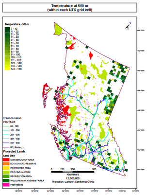
The purpose of the project is to provide publicly available maps, databases, protocols, and tools which may be used as a resource and/or investment tool for assessing and exploiting geothermal resources in Canada.

There are currently databases/maps for 4 provinces/territories: Alberta, British Columbia, Yukon, and Nunavut.

Goals of CNGD

The CNGD initiative is in line with the goals of the global geothermal industry, which are to:​
  • Improve accessibility of information and knowledge as a risk mitigating effort in geothermal
  • Reduce fragmentation of data collection and avoid duplication of efforts
  • Increase reliability of available data
  • Increase awareness of geothermal energy potential and utilization

CNGD Features

  • Temperature at depth
  • Thermal conductivity 
  • Heat flow
  • Well logs
  • Bottom hole temperatures (BHT) 
  • Drill stem test (DST)
  • Permafrost data
  • Seismicity/microseismicity
  • Porosity/permeability data 
  • Water chemistry
  • Geophysical surveys 
  • Geothermal resources  (direct-use, hydrothermal, petrathermal, hot sedimentary aquifer, geopressured, geothermal fluids co-produced with oil and/or gas)

Uses for CNGD

  • Investigate areas in Canada with high geothermal anomalies
  • Provide a level of resource estimate confidence consistent with geothermal reporting codes.
  • Increasing identification of favourable areas with land use information. Subsurface favourability maps have also been considered
  • Serve as a geothermal exploration tool for making informed business decisions, as well as a means for mitigating investment risks
  • ​Identify regions of little or no data available to promote further data collection and research
Picture

Alberta Geothermal Resource Estimate data & maps

Yukon Territory Geothermal Resource Estimate data & maps

British Columbia Geothermal Resource Estimate data & maps

NUNAVUT TERRITORY GEOTHERMAL RESOURCE ESTIMATE DATA &  MAPS
The database was established and is hosted by CanGEA. Data sources include historical data and existing geothermal resource assessment data already compiled by universities, research organizations, as well as private and publically funded geothermal exploration projects. Data sources include historical data and existing geothermal resource assessment data already compiled by universities, research organizations, as well as private and publically funded geothermal exploration projects. The Canadian version of the Protocol's methods and data sources for estimating geothermal resources is public and available following a detailed review from ‘Qualified’ individuals from the Australian Protocol development team, along with authors of the Canadian Geothermal Code for Public Reporting. Anticipating any future changes and/or advancements in geothermal technology, the Canadian version of the Protocol will also serve as a ‘living document’ and will remain open to continuous review.
jQuery UI Dialog - Default functionality

Distinct from other geothermal resource maps developed in Canada, the maps follow international guidelines already adopted in the U.S., Australia, South Korea, Spain, and Europe and have been adapted for compliance with the

Canadian Geothermal Code for Public Reporting.

Presented to the public in a universal mapping platform and centralized national geothermal database, the project deliverables also provide a means to share, collaborate or update data necessary for making informed business decisions.

CanGEA

Home
About
News
Contact
Donate


More

Events
Reports
Geothermal Resource Estimate Maps
Membership
A Geothermal Discussion
Follow Us

Twitter
LinkedIn
YouTube

Picture
Buy me a coffeeBuy me a coffee
Copyright © 2023 | Canadian Geothermal Energy Association | All Rights Reserved